The European Centre for Medium-Range Weather Forecasts (ECMWF) has worked side by side with many specialised institutions and excellence centres from across Europe during the first phase (2022-2024) of the Destination Earth (DestinE) initiative of the European Commission. These actions have engaged users from the earliest phases, following a co-design approach, and have contributed to demonstrating the added value of DestinE digital twins. Let’s review some key developments of our DestinE “use cases” during Phase I.
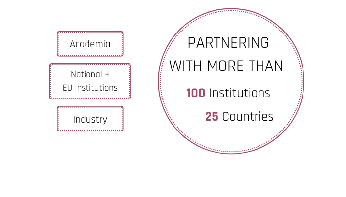
The fast-paced development of first two digital twins in DestinE by ECMWF wouldn’t be possible without the active participation of many co-development partners, roughly a hundred entities across Europe. Public and private sector experts have contributed to everything from building, testing and demonstrating the potential advantages of the digital twins and their novel data, to engaging with end users and collect their feedback, their needs and priorities that help shape DestinE.
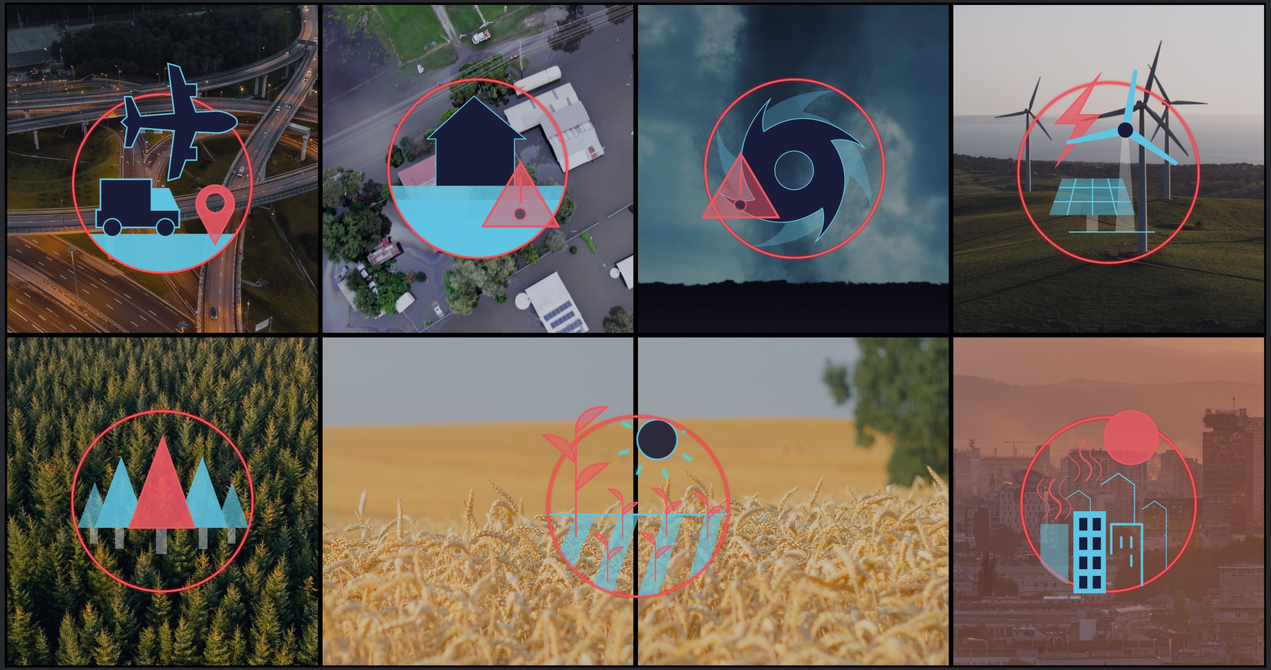
The ambitious initiative of the European Commission to develop a digital replica of the Earth system has had a determined engagement with its future users from the very beginning. ECMWF developed examples showing how some of the key target sectors may benefit from the digital twins by contracting technical institutions throughout Europe with developing these. Examples include the management of energy systems or renewable energy production, disaster risks (floods, storms, wildfires) or public health (urban heat stress, air quality). Selected use cases are also included in the contracts for developing the digital twins.
European collaboration for implementing a shared vision
Initially, many of these partners relied on current operational data, including from the Copernicus services, ECMWF and national meteorological services, since the digital twins’ data only became available during the time of the contracts. Progressively, these demonstrators have integrated the more advanced digital twins’ data and workflows, which offered higher resolution and more detailed insights.
Jörn Hoffmann, Applications Partnership Lead at ECMWF for DestinE, emphasizes the importance of this collaborative approach:
“Our partners have started to demonstrate different uses of DestinE data. As early users of DestinE they have been at the forefront of shaping the system. “
| Feature | State-of-the-art | Climate DT |
| Climate variable | 10m wind components (u10, v10) Requires interpolation for turbine height level (~ 100m) | 100m wind components (u100, v100) |
| Temporal resolution | 3 to 6 hours | hour |
| Spatial resolution | 100 km (CMIP) 12.5 – 50 km (CORDEX) | 5 km |
| Location | RCMS / downscaling required for regional climate information | climate information with local granularity available globally |
Using the Climate Change Adaptation Digital Twin (Climate DT) data
The Climate DT is being developed by a consortium led by Finland’s CSC IT Center for Science involving climate, supercomputing and weather centres in six countries, in close partnership with ECMWF. Several developments have demonstrated the potential added value of the system. The high resolution, multi decadal simulations of the Climate DT, which provide global information at scales where many of the effects of climate change and extreme events are observed, offer interesting perspectives for sectors highly dependent on climate information such as energy or infrastructures.
Optimising energy systems with Climate DT data
One contract explored the potential of Climate DT data for optimising energy grid planning.
The German Aerospace Center (DLR) together with Aarhus University (AU) and the Renewables Grid Initiative (RGI) have created a set of tools that support the use of climate data for energy operators. The team worked with selected user groups to gather detailed requirements via a User Perspectives Workshop and direct contacts.
First, this approach has proven effective to gain an in-depth understanding of the user’s expectations. Transmission System Operators for energy are hoping for tools that facilitate the task of integrating climate and weather information in their energy system models and planning cycles.
The work to date resulted in a demonstrator that integrates power system simulations with climate data at a relatively small computational cost and adapting the complex data to make it more accessible. Additionally, thanks to machine learning techniques, the team managed to speed up the simulations.
Bruno Schyska from DLR highlights the importance of these developments:
“High-quality projections for future meteorological conditions are critical for grid-planning and adequacy assessments. We have demonstrated how DestinE can help with this task.”
Andrzej Ceglarz from RGI adds:
“Energy sector actors, especially grid operators, rely more and more on accurate weather forecasts and high-quality climate projections. DestinE promises to become an important and relevant source of information for the sector.”
Addressing policy and environmental challenges with enhanced data applications
The applications Energy Onshore and Energy Offshore developed by a team including scientists from Finland’s Meteorological Institute (FMI) and the Barcelona Supercomputing Center (BSC) provide enhanced wind and solar data from climate projections. The objective is to develop relevant information for policymakers, providing evidence-based facts to make energy policy decisions. The European Commission’s Joint Research Centre was involved as a key user.
The first tests using existing operational models, but also the Climate DT data, have demonstrated benefits for offshore operators as well as inland wind-related industries. The team demonstrated the feasibility of spatially detailed estimates of the evolution of wind speeds in the future (up to 2040, for now).
Near-surface wind speed, on a grid of 100 km resolution – corresponding to previous global climate simulations, and of 5 km resolution – as simulated in one of the prototype runs of the Climate DT. Use the slider to compare the different resolutions. Credit: Aleksander Lacima-Nadolnik & Katherine Grayson, BSC, Climate DT Team
In the future the Climate DT data should help investigate questions of operators involving several variables like:
- ‘Which months of the year are suitable for installation work?’
- or ‘Is my exploration site accessible year-round given the operational limits of the vessels I have access to?’
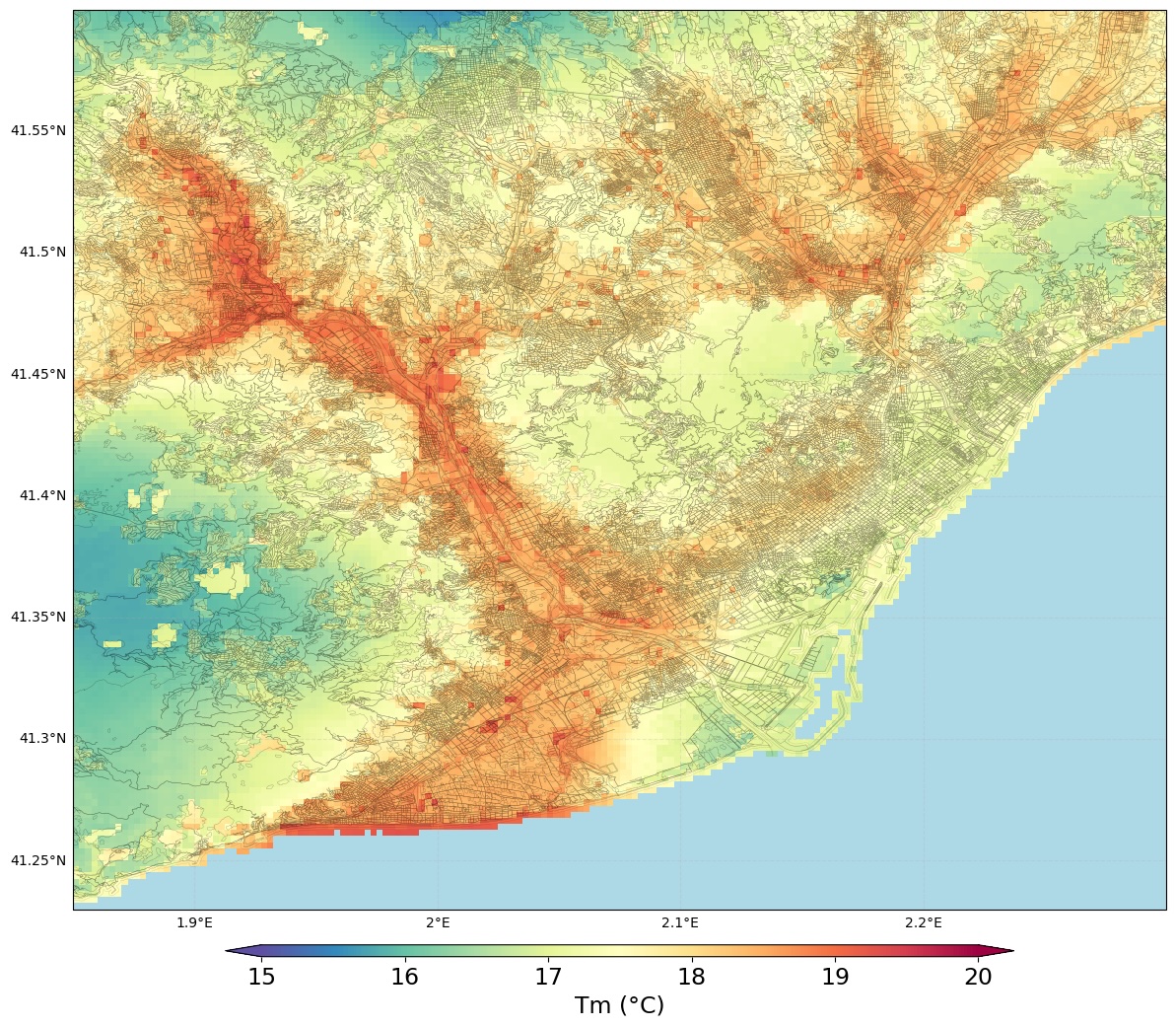
Other work demonstrated how Climate DT data could contribute to managing the pressing issue of urban heat, as heatwaves become more frequent and more intense with climate change. CSC IT Center for Science and BSC worked together to develop the application “Urban Heat,” listening to the requirements of its main user, the Portuguese non-profit research +Atlantic.
The Belgian research institute VITO has developed a different approach to tackle the same issue. Using the Climate DT data downscaled with their state-of-the-art UrbClim model, they are producing hourly air temperature and thermal comfort indicators at a spatial resolution of 100 m.
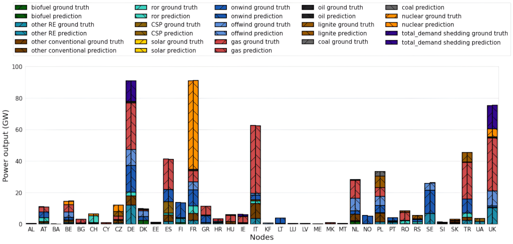
Other developments demonstrating the use of Climate DT data included examples for compound flood risk management, harvestability of forest, wildfire management or global hydrology.
Using the Weather-induced Extremes Digital Twin (Extremes DT) data
The Extremes DT consists of a global component, delivering regular predictions of global weather 4 days ahead at 4.4km spatial resolution horizontally, and a regional (European) component that can be activated on-demand.
The global component is developed by ECMWF, building on the developments of its Integrated Forecasting System, which is used for producing operational medium-range weather forecasts at 9km resolution.
The regional on-demand component of the Extremes DT is being developed by a consortium of national meteorological and hydrological services led by Météo France in close partnership with ECMWF. From the earliest stages of the initiative, users from the sectors most impacted by weather extremes have been involved in the design, developing demonstrators and providing feedback with their main requirements.
Applications and enhancements in Air Quality and Forestry
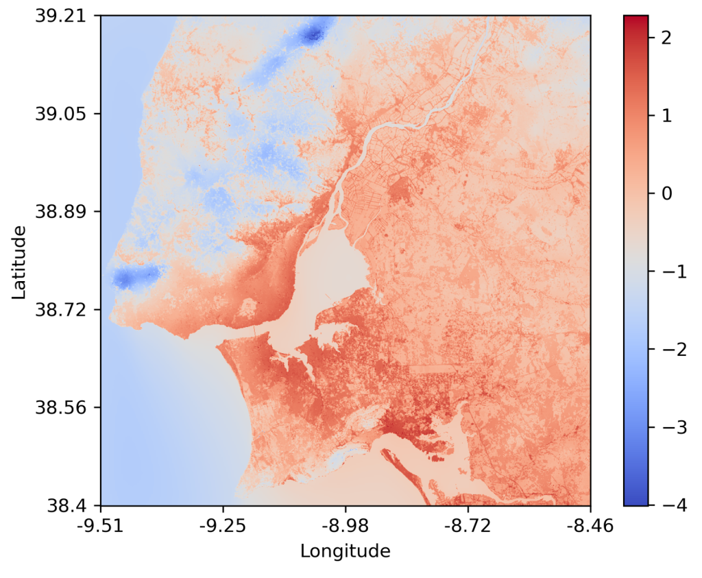
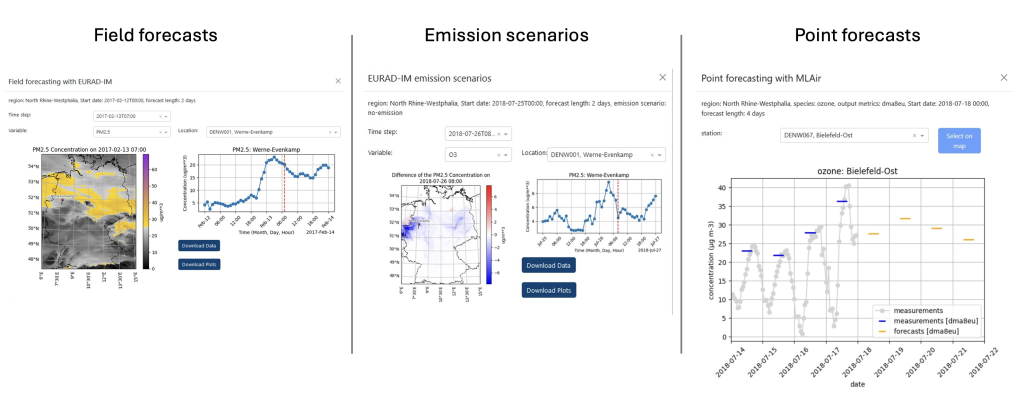
To exploit the high spatial resolution of the Extremes DT, the German research center Forschungszentrum Jülich (FZJ) has developed a tool for higher resolution air quality forecasts and interactive emissions scenarios using the Extremes DT data via the software layers of the Digital Twin Engine, a key component of DestinE also developed and delivered by ECMWF. An interactive user interface allows a flexible domain selection and allows users to initiate simulations for different scenarios. Watch a video presentation of the Air Quality use case here.
During Phase 1of DestinE, FZJ used their in-house supercomputer and air quality model EURAD-IM (European Air pollution Dispersion – Inverse Model), included in the Copernicus Atmosphere Monitoring Service regional ensemble model, at high (down to 1km) horizontal resolution.
The demonstrator was developed in co-design with its users, the German Environment Agency (Umweltbundesamt – UBA) and North Rhine-Westphalia Office of Nature, Environment and Consumer Protection (Landesamt für Natur, Umwelt und Verbraucherschutz Nordrhein-Westfalen – LANUV), adapting to their requirements.
In a separate development, FMI together with the forestry specialist Metsäteho Oy, which provides information on the conditions for forestry operations, were able to expand their existing services by new information on storm damage and improve the data output using machine learning algorithms. Thanks to Metsäteho Oy close cooperation with the forestry sector, the team was able to collect feedback and requirements from users primarily in Finland but reaching out also to users outside.
The team implementing the on-demand Extremes DT, led by Météo France, compared the results of high-resolution (750×750 m) air-quality models nested in meteorological models with the current operational Copernicus ensemble air quality model. The team used the forcing from the enhanced resolution of meteorological models from prototype simulations of the on-demand Extremes DT to six of the 11-member ensemble model for two case studies. They concluded that the results are promising, but further developments are needed to achieve better results at such fine scales. This prepares the ground to understand the gaps that must be filled to achieve higher resolution air quality simulations.
In the framework of the on-demand regional component of the Extremes DT, the integration of DestinE data in the hydrological models of nine national meteorological services was also tested. Results indicate that higher resolution improves on reference simulations, particularly where topography strongly influences the results.
A real need for DestinE data: user feedback and future directions
The first phase of DestinE has been marked already by explorative user engagement, with feedback gathered through surveys, dedicated meetings and general DestinE events such as the User eXchange. This feedback was very valuable for including the expectations regarding the DestinE system and ensuring it meets the specific needs of different sectors.
The need for higher resolution data was unanimously requested by users of the Disaster Risk Mitigation and Climate Adaptation demonstrator project, led by the Dutch infrastructure and flood specialist Deltares.
In the framework of the Climate DT, CSC and BSC delivered the promising Urban Heat application that showed its ability to provide 5 km resolution UHI data for cities across the Iberian Peninsula, focusing on Barcelona. +Atlantic, for the Urban Heat application, stressed their need to improve their understanding of how climate change will impact urban areas. The team suggested that enhanced extreme heat indicators, produced by downscaling the Urban Heat Island effect (UHI), can be very useful for this purpose as it allows to represent the physical processes of this phenomenon at even finer scales.
In the case of the Onshore Offshore energy applications, the team stresses a need for further stakeholder engagement. The user requirements, including a demand for enhanced information about wind energy potential, accessibility and improved spatial optimisation were gathered via different user interactions.
The Joint Research Centre (JRC) outlined requirements for the Onshore application developed in the Climate DT, including information on heating and cooling days, related to electricity demand, multi-decadal extreme wind and extreme event projections and the possible future changes in wind distribution. Some of these requirements were not addressed in Phase I due to their feasibility, showing that these demonstrators are an ever-evolving work in progress.
The Helmholtz Center for Environmental Research (UFZ) also developed the application HydroRiver – working with the German Technical and Scientific Association for Gas and Water (DVGW) and the European Environmental Agency (EEA). Both institutions generally requested the highest spatial and temporal resolution possible to assess the impact of climate change in hydrology, creating a sophisticated tool for advanced hydrological modelling, offering capabilities for climate impact assessment, scenario analysis, and policy evaluation with a user-centric approach.
On the occasion of the launch of the DestinE system, users explained their need for DestinE digital twins data for energy, extreme events or urban planning. Find out more.
A promising start and many plans for the future
The co-design experience during the initial phase has shown that DestinE can be a meaningful source of climate and weather information, complementary to the work of existing national and European services.
The users engaged so far reveal a real appetite for DestinE digital twins data. Policymakers and private operators alike are demanding more accurate but also more flexible information systems. These should provide them with the information they need, in a timely manner and easy to access and analyse.
The applications and demonstrators developed during Phase I have shown that Destination Earth digital twins can address these demands, albeit more work is needed in further phases to refine, define the applications and move forward towards operationalisation. Some new projects are now set up for Phase II in the framework of the contracts implementing the Climate DT and the on-demand Extremes DT, like the Global Freshwater Availability project implemented by UFZ under the contract for implementing the Climate DT led by CSC IT Center for Science. Further pilot services will be implemented in new contracts for additional impact sector applications. All these take advantage of the many lessons learned and the readiness of the system.
Both the project leaders and the users stressed their satisfaction with the potential applications of DestinE digital twins data but also the necessity and their eagerness to continue the work initiated, especially now that the applications can fully integrate the digital twins high-resolution data.
Discover more about the Uses of DestinE in our dedicated page.
Destination Earth is a European Union-funded initiative launched in 2022, with the aim to build a digital replica of the Earth system by 2030. The initiative is being jointly implemented under the leadership of DG CNECT by three entrusted entities: the European Centre for Medium-Range Weather Forecasts (ECMWF), responsible for the creation of the first two ‘digital twins’ and the ‘Digital Twin Engine’, the European Space Agency (ESA) responsible for building the ‘Core Service Platform’, and the European Organisation for the Exploitation of Meteorological Satellites (EUMETSAT), responsible for the creation of the ‘Data Lake’.
We acknowledge the EuroHPC Joint Undertaking for awarding this project strategic access to the EuroHPC supercomputers LUMI, hosted by CSC (Finland), and the LUMI consortium, Marenostrum5, hosted by BSC (Spain) Leonardo, hosted by Cineca (Italy) and MeluXina, hosted by LuxProvide (Luxembourg) through a EuroHPC Special Access call.
More information about Destination Earth is on the Destination Earth website and the EU Commission website.
For more information about ECMWF’s role visit ecmwf.int/DestinE
For any questions related to the role of ECMWF in Destination Earth, please use the following email links: