Weather-Induced Extremes Digital Twin
What is the Extremes DT?
The DestinE Digital Twin for Weather-Induced Extremes (Extremes DT) supports responding and adapting to extreme events in a changing world by providing a capability to produce tailored simulations and address what-if scenarios related to extreme events in a past, present and future climate, complementing existing capabilities at national and European level.
The Extremes DT combines cutting-edge Earth-system models, impact-sector models and observations. It uses a global and a regional component to provide information on extreme events on a timescale of a few days ahead, at very high spatial resolution (4.4 km globally, 500 – 750 m over Europe). Data from the global component is already available regularly through the DestinE platform for users with upgraded access.
The Extremes DT in a nutshell
The Extremes DT sets up a unified, flexible, framework to simulate extreme weather events and their associated impacts at km-scale resolutions, using the world-leading supercomputing facilities of the EuroHPC Joint Undertaking. A concise overview of what the Extremes DT aims to achieve, and the different concepts essential for an understanding of the Digital Twin’s characteristics is included in the Extremes DT factsheet.

General factsheet on Weather-Induced Extremes Digital Twin
The Extremes DT in more detail
The Extremes DT relies on high-resolution Earth-system simulations, their fusion with Earth system observations, and flexible workflows that directly link Earth-system simulations with impact models, through a co-design approach. The Extremes DT will allow to carry out tailored simulations, both regularly and on-demand for key selected stakeholders. These simulations will help to understand past, present and future extreme weather events, and explore the potential efficacy of adaptation measures in mitigating their impact. It complements existing capabilities for simulating weather extremes and their impacts, supporting national authorities in their mandates to respond and adapt to the consequences of extreme events.
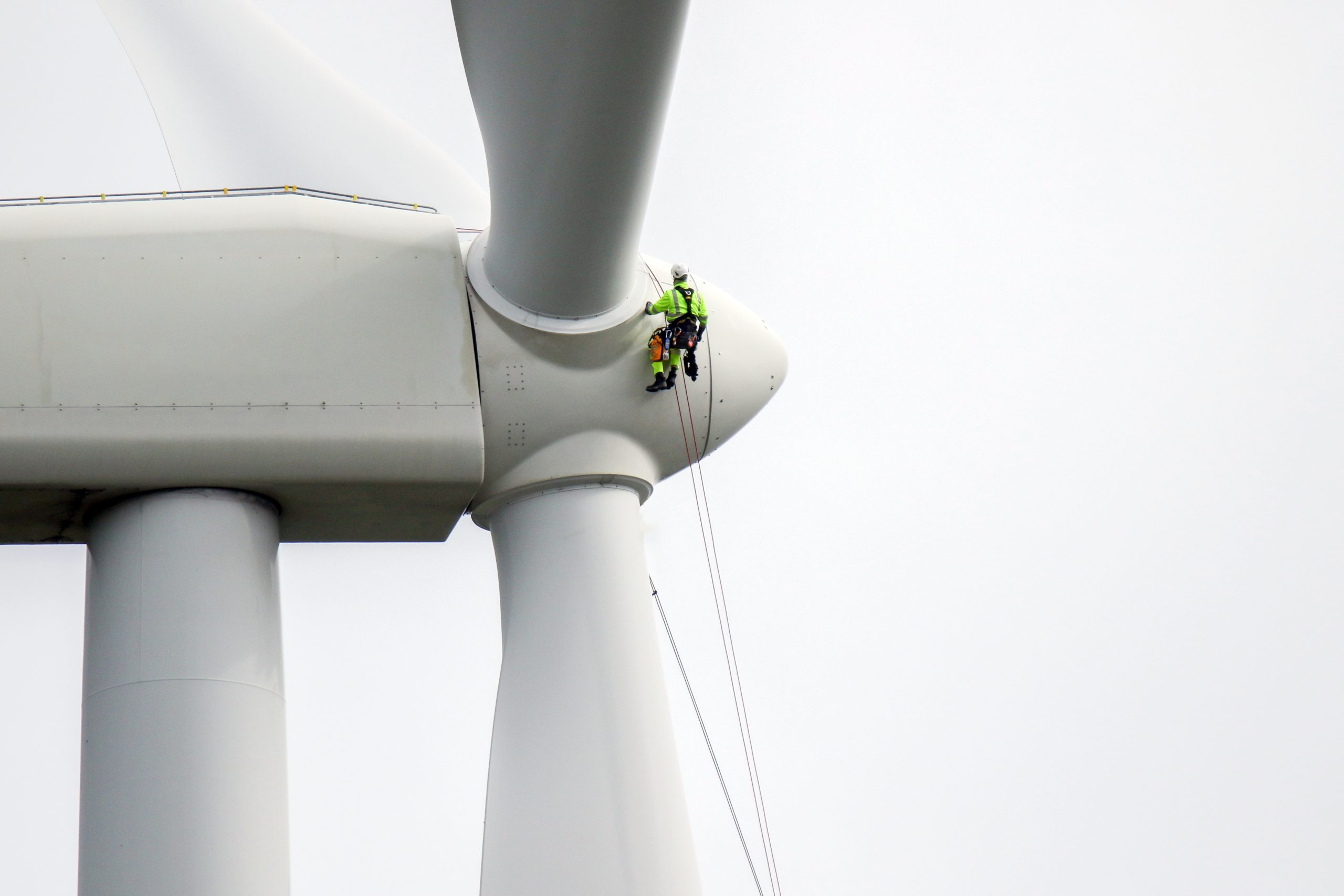
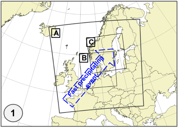
The Extremes DT has a global component, developed by ECMWF, producing global simulations at resolutions of 4.4 km kilometres up to four days ahead. A regional component, that can be used to zoom on extreme events occurring over Europe, will follow later in 2025. It will produce simulations at 500 to 750 metres up to two days ahead. The regional component is developed by a partnership led by Météo-France, involving 32 institutions in over 20 countries, including many national meteorological services (NMS) throughout Europe, through a contract procured by ECMWF.
During the first phase of DestinE (2022-2024), the focus was on building the main elements of the Extremes DT and on piloting the system on the available EuroHPC systems. Its capabilities were demonstrated at scale, through the production of the first global predictions at km-scales, and regional predictions at sub-km scales. Currently, in the second phase of DestinE (2024-2026), the focus is on consolidating, operationalizing and further evolving the Extremes DT system, aiming to gradually enhance its capabilities, in particular in terms of AI, and uncertainty quantification.

Models
The global component of the Extremes DT builds on ECMWF’s Integrated Forecasting System. It is based on the configuration used operationally at ECMWF, by further increasing the resolution of several components of the Earth System Model (atmosphere, land and waves) to a resolution of 4.4 km. The ocean component remains unchanged and is NEMO on the ORCA025 grid.
The regional component developed by Météo-France and its partners, builds on the ACCORD system and can be configured (e.g. for regions, event types) for selected extreme events over Europe at sub-kilometre resolutions (500 to 750 m). Several impact-sector models for floods, air quality and renewable energy are being integrated in its workflow.

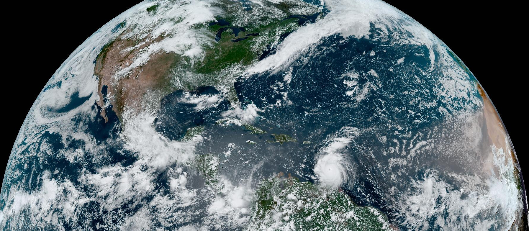
The simulated infrared brightness temperature for a 36-hour forecast at a 4.4 km resolution initialized on August 28th (left) with corresponding visible reflectance (center) captures the deep convective clouds of hurricane Idalia during landfall, as well as the eye structure of hurricane Franklin. Satellite observations in the early morning hours (right) show the spiraling cloud bands of hurricane Franklin with the eye structure, just two hours before Idalia makes landfall.
Simulations
The global Extremes DT simulations are carried out by ECMWF on EuroHPC supercomputers.
The global component of the Extremes DT provides four-day global simulations with a resolution of 4.4 km, initialized daily from the 00UTC ECMWF operational analysis at a resolution of 9 km (depending on EuroHPC availability, and queuing times). Currently, these simulations are performed on LUMI and available via the DestinE platform for users with upgraded access.
The regional DT simulations carried out by the partnership led by Météo-France, for extreme events occuring over Europe, are forced at their lateral boundaries by the outputs of the global Extremes DT and will become available later in 2025.
In later phases of DestinE, the capability to perform simulations for extreme events in a future climate will also be developed. This can be achieved by exploiting the synergies of having the same underlying global model in the Extremes and Climate DTs to initialise, and drive, the regional component from either the global Extremes DT or from Climate DT simulations.
Access the Extremes DT data
Extremes DT data can be accessed by registering on the DestinE Service Platform and requesting upgraded access.
Native model output at high resolution can be retrieved using the polytope service, for the past 15 start dates for which simulations were carried out.
Various parameters for land and atmosphere are included in the data portfolio with a full list provided on the DestinE Extremes DT Parameters page. Examples for retrieving, analysing, and plotting data are provided here.
The Harmonised Data Access (HDA) offers access to entire DestinE Data Portfolio, via a single API, allowing to access the multiple diverse datasets included in the data portfolio. It also utilises the polytope API without modifying the digital twins data.
Various services available on the DestinE platform can be used to explore Extremes DT data.