Climate Change Adaptation Digital Twin
What is the Climate DT?
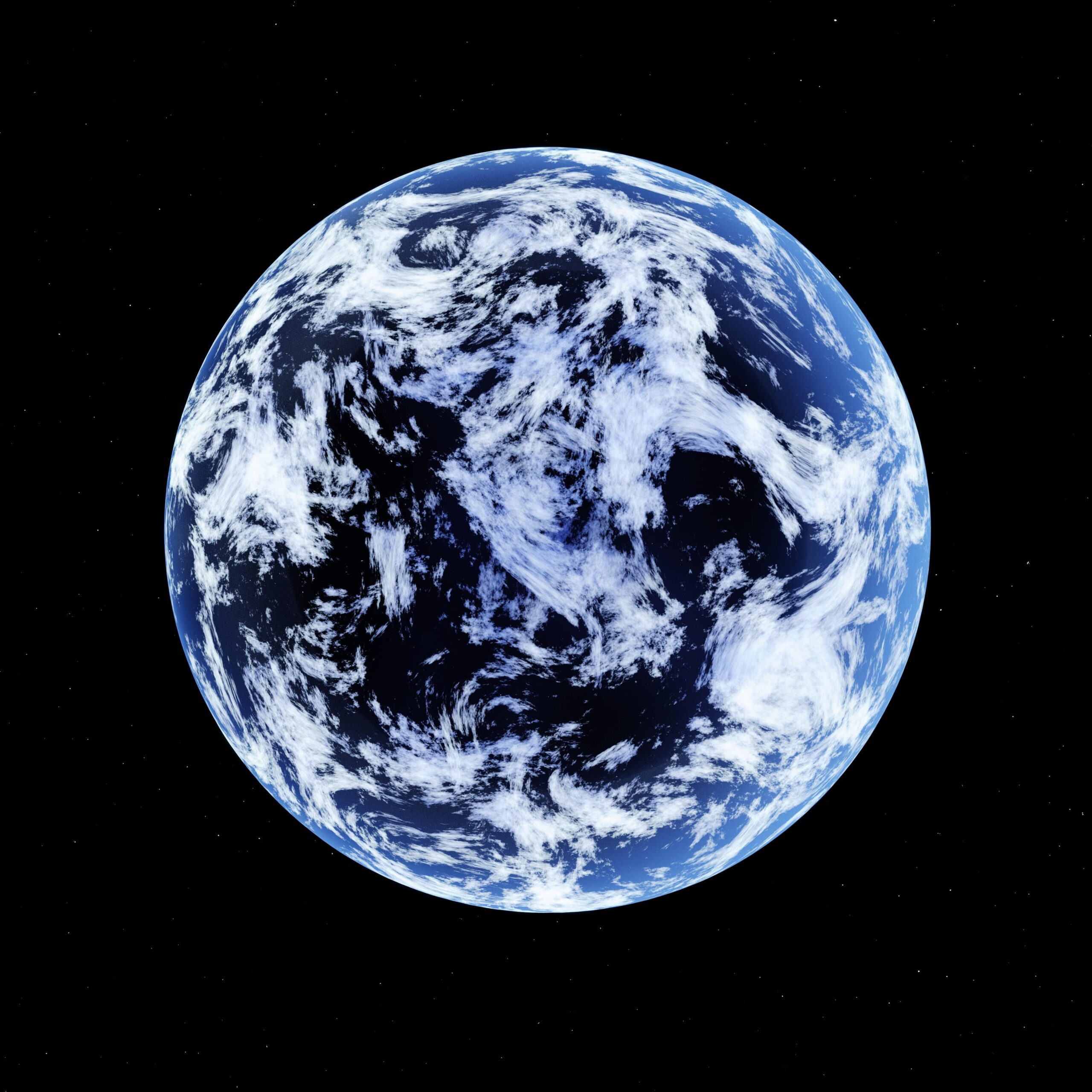
The DestinE Digital Twin for Climate Change Adaptation (Climate DT) supports adaptation activities by providing innovative climate information on multi-decadal timescales, globally, at scales at which many impacts of climate change are observed. It combines cutting-edge global Earth-system models, impact-sector applications and observations into a unified framework to provide global climate projections and impact-sector information on multi-decadal timescales (1990 to ~2050), at very high spatial resolutions (5 to 10 km). The data from the first prototype projections is already available through the DestinE platform for users with upgraded access.
The Climate DT is implemented by a partnership led by CSC, currently involving 12 leading climate institutions, supercomputing centres, national meteorological services, academia and industrial partners, through a contract procured by ECMWF.
The Climate DT in a nutshell
The Climate DT represents the first ever attempt to operationalise the production of global multi-decadal climate projections, leveraging the world-leading supercomputing facilities of the EuroHPC Joint Undertaking along with some of the leading European climate models. A concise overview of what the Climate DT aims to achieve, and of the different concepts essential for an understanding of the Digital Twin’s characteristics, is included in the Climate DT factsheet.

General factsheet on Climate Change Adaptation Digital Twin
The Climate DT in more detail
The Climate DT creates an operational framework that will allow to produce global multi-decadal climate projections (until 2050) on a regular basis (i.e. yearly). It will also allow to produce bespoke simulations, on-demand, to address ‘what-if’ questions related to the impact of certain scenarios or policy decisions on the evolution of our planet, or to create storylines of how extreme events already experienced by climate-vulnerable sectors may look over the next decades. By doing so, it will support decision-making for climate change adaptation and the implementation of the European Green Deal.
This digital twin relies on global km-scale climate models and flexible workflows, including directly linked impact models and applications that translate climate data into actionable information on climate change impacts for impact sectors like wind energy or water management, through a co-design approach. Key features developed over different phases of DestinE include an operational framework that includes monitoring, evaluation, quality assurance and uncertainty quantification, as well as interactivity elements, allowing enhanced responsiveness to emerging user needs. The involvement of selected users from the start has been key to ensure that they will obtain the climate information they require.
During the first phase of DestinE (2022-2024), the focus was on building the main elements of the Climate DT and on piloting the system on the available EuroHPC systems. Its capabilities were demonstrated at scale, through the production of the first prototype multi-decadal projections at km-scales. Currently, in the second phase of DestinE (2024-2026), the focus is on consolidating, operationalizing and further evolving the Climate DT system, aiming to gradually enhance its capabilities, in particular in terms of AI, uncertainty quantification and interactivity elements.
The Climate DT complements current climate modelling activities by:
- providing globally consistent climate data with higher temporal and spatial resolution (5 to 10 km globally instead of more than 100 km, hourly instead of 6‑hourly output)
- operationally producing updated quality-controlled climate information routinely (yearly or less, compared to every seven to ten years today)
- providing a framework to perform bespoke, “what-if”, climate simulations, on demand for selected key stakeholders
- considering the needs of users in terms of output variables and simulation design
Factsheet wind energy use case
 |
This fact sheet outlines how the Climate DT is developing a wind energy application that includes high-resolution global information on both on-shore and offshore wind energy. Credits: Climate DT consortium. |
A comparison of the resolution used within DestinE and the 1° standard resolution. Not only is the spatial resolution higher, but the temporal frequency is also higher. The images show the temperature and wind at the surface. The data come from the simulation of the SSP3-7.0 scenario using the IFS-NEMO model (with a resolution of 4.4 km for the atmosphere and land and 1/12th of a degree for the ocean and sea ice). Credit: Barcelona Supercomputing Center (BSC)
Models
The Climate DT exploits and further evolves a new generation of global storm-resolving and eddy-rich models built through a cooperative model development approach. It is supported by the EU Horizon projects nextGEMS and EERIE as well as national projects, such as WarmWorld in Germany and Gloria in Spain, involving dozens of leading climate and weather centres, supercomputing centres and academia throughout Europe. The three models used are ICON, IFS-NEMO and IFS-FESOM. They are run at resolutions ranging between 5 and 10 km for the different Earth-system components (atmosphere, land, ocean and sea ice).
- ICON is the ICOsahedral Non-hydrostatic model developed by the German Meteorological Service (DWD), the Max Planck Institute for Meteorology (MPI-M), the German Climate Computing Centre (DKRZ), the Karlsruhe Institute of Technology (KIT), and the Center for Climate Systems Modeling (C2SM)
- IFS-NEMO is ECMWF’s Integrated Forecasting System (IFS) coupled to the latest release of the NEMO ocean model implemented by BSC in collaboration with ECMWF
- IFS-FESOM is the ECMWF IFS coupled to the Alfred Wegener Institute’s Finite-VolumE Sea ice–Ocean Model
A simulation of surface temperature from one of the prototype projections of the Climate DT performed on EuroHPC LUMI with IFS-NEMO (at 4.4 km resolution for atmosphere and land and 1/12 degrees for ocean and sea ice). Credit: ECMWF / Andreas Müller / LUMI
Simulations
The Climate DT team carries out several types of digital twin simulations on the EuroHPC supercomputers. Multi-decadal simulations are produced to cover the recent past (from 1990) and possible future evolutions of the climate up to 2050.
The simulations of the past are used to evaluate the model quality before using the future projection to quantify how characteristics of the climate and weather change over the next decades. So-called storyline simulations, are carried out to reconstruct the unfolding of recent extreme events, such as heatwaves, floods, and droughts across various climate conditions.
The simulation protocol is inspired by the Coupled Model Intercomparison Project CMIP and in particular by the High Resolution Model Intercomparison Project (HighResMIP). DestinE further adapts these protocols for km-scale simulations, which complement the existing climate projections.
The video offers a comprehensive overview of how this complex system operates, guiding viewers through the process of running a high-resolution simulation with the Climate Adaptation Digital Twin. It highlights the various steps involved in the novel workflow that drive the Climate Twin’s activation when simulating the planet’s evolution.
Read more on the different types of simulations:
Starting in 1990, the forcing follows observed changes in greenhouse gases, aerosols etc. until 2020. The simulations are using standardised CMIP6 forcing. Historical simulations are essential for model evaluation and quality control as they allow a comparison to observations.
To project how climate will change on a global and local scale in the future, forcing changes according to the Shared Socioeconomic Pathway (SSP) 3-7.0 scenario from ScenarioMIP. The SSP3-7.0 scenario explores a future with a continuous increase in CO2 emissions with no strong mitigation efforts. All DestinE projections carried out so far follow this scenario. In the future, alternative future scenarios will be explored. The projections carried out so far are initialised in 2020 from reanalysis followed by a 5-year ocean spin-up. For the upcoming simulations carried out in phase 2 of DestinE, scenario simulations will extend the historical simulations.
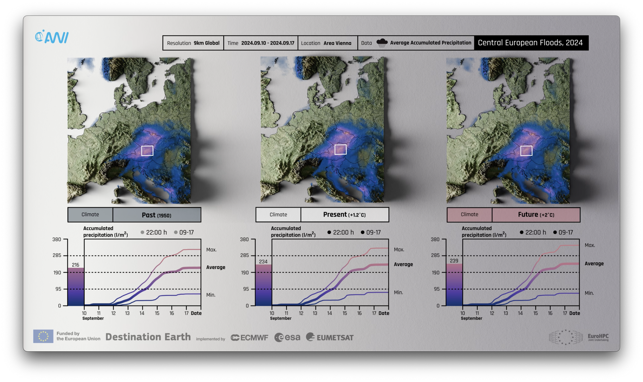
Storyline simulations offer a what-if capability to explore how a weather event we experienced in the recent past would change in a warmer climate and how it would have looked in past pre-industrial conditions. To constrain simulated weather events, a nudging approach is used to keep the simulated large-scale flow close to the ERA5 reanalysis for the period 2017 – 2023. Processes on smaller scales and thermodynamic processes are free to evolve, which allows scientists to study e.g. how extreme precipitation would change in a warmer world for a weather event observed in present-day conditions. Initial conditions are taken from ocean-only spinup simulations for 1950 and 2017, and from the IFS-FESOM projection for a +2 °C world. Storyline simulations will be updated regularly to include most recent months. The next update will extend all storylines to include 2024.
Repetitive 1990 forcing with no change in forcing over time. These simulations allow to quantify model drift and simulated inter-annual variability and provides relevant context for interpreting historical and scenario simulations.
For coupled climate simulations, it is essential to bring the ocean close to an equilibrated state before launching the coupled simulation. For the historical simulations, the ocean models are initialised from a reanalysis in 1985, and then forced by ERA5 for 5 years. In 1990, a coupled 2-year spinup with perpetual 1990 forcing starts from the ocean-only spinup to reduce the coupling shock. This coupled spinup is then used to provide the initial conditions for the historical simulations starting in 1990. For the scenario simulations, the ocean-only spinup is running from 2015 – 2019 with ERA5 forcing and is directly initialising the coupled future projection with no coupled spinup. The Climate DT will continue to explore and improve spinup strategies in the future and run scenario projections as a direct continuation of the historical simulations.
Available Climate DT simulations
The table below lists the first prototype multi-decadal simulations (up to 2040) carried out in the first phase of DestinE, that are already available in the Data Lake and via the DestinE platform for users with upgraded access.

Simulations with upgraded climate models, that will also follow more closely the HighResMIP protocol, will become available early 2026. Work on evaluation and uncertainty quantification is also ongoing and more information will be made available soon.
Access the Climate DT data
Data from the Climate DT simulations can be accessed by registering on the DestinE Service Platform and requesting upgraded access.
Native model output at high resolution can be retrieved using the polytope service.
Various parameters for the ocean, atmosphere, sea ice and land are included in the data portfolio with a full list provided on the DestinE Climate DT Parameters page. Examples for retrieving, analysing, and plotting data with the polytope service are provided here, and a concrete notebook example for plotting one variable from the climate runs can be found here.
For the nextGEMS simulations, the data portfolio is provided at the nextGEMS data catalogue page. A concrete notebook example for plotting one variable from these runs can be found here.
The Harmonised Data Access (HDA) offers access to entire DestinE Data Portfolio, via a single API, allowing to access the multiple diverse datasets included in the data portfolio. It also utilises the polytope API without modifying the digital twins data.
Various services available on the DestinE platform can be used to explore Climate DT data.