

Pilot Service – High-Resolution Precipitation-to-Flood Signals
High-resolution precipitation forecasts using Destination Earth
Main contractor: Agenzia ItaliaMeteo (Italy)
What is it? Provide flood information for the Italian territory using high spatial and temporal resolution data from the Weather-Induced Extremes Digital Twin (Extremes DT) combined with hydrological models and regional ICON predictions, a model which comprises component models for the land, ocean and atmosphere.
Concrete applications examples:
Support decision-making to reduce the impacts of flooding caused by precipitation in Italy, with approaches adapted to the territorial and socioeconomic context of different locations. This Pilot Service also anticipates early flood risks by possible river overflows over small and medium catchments, using machine learning (ML) enhanced indicators.
The system will include the full chain of the targeted extreme event, from rainfall indicators to indications for potential floods.
Main target end users:
Italy’s National Civil Protection System and Italian Regional Functional Centres.

The Flood Signals Pilot Service aims at providing enhanced river flow information at high spatial resolution, for rivers in a particular Italian river network, triggered by precipitation indicators.
Factsheet: Click the graphic below to view the full PDF factsheet on the Pilot Service – High-Resolution Precipitation-to-Flood Signals.
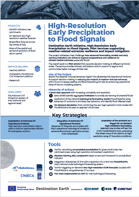
Digital twin data for flood risk management in Italy
To deliver this DestinE Pilot Service, Agenzia ItaliaMeteo collaborates with Germany’s Deutscher Wetterdienst, CIMA Research Foundation—one of the leading institutions supporting the Italian National Civil Protection through hydrological simulations, warning systems, communication, and data management—and CINECA, which hosts Leonardo, Italy’s largest supercomputing centre. Together, the partners have developed and are operating a workflow that provides detailed flood potential information, including on-demand high-resolution modelling for selected regions of Italy.
The team aims to pilot deriving detailed information of flooding potential, including through the use of an on-demand model workflow for selected regions in Italy.
The pilot service exploits the DestinE Extremes DT products in two main complementary components:
First, it will calculate accumulated precipitation for Italian river catchments based on the high-resolution atmospheric predictions of the digital twin, combined with a hydrological interface that will estimate the water inflow into the river catchments, to understand how precipitation accumulates within these areas. More information can be found here.
Second, using machine learning (ML) the system will also integrate measurements from gauging stations and other sensors, helping calibrate the influence of precipitation in a given river catchment and adapting to local hydrologic conditions for enhanced accuracy.

The information is integrated into national forecasting systems merging the data provided by FloodPROOFS, a hydrologic model covering the entire Italian territory at a spatial resolution of 500m, and the high-resolution weather data provided by the Extremes DT. The integration will enhance the flood modelling capabilities, providing improved geographical information on the location and intensity of flood forecasts. Italy’s National Civil Protection System will benefit from this multi-model approach, homogeneous at the national level.

In addition, the consortium has evaluated the Pilot Service products through selected case studies across Italy to demonstrate their added value. These activities have assessed the usability of the products for triggering on-demand high-resolution forecasts using the Extremes Digital Twin simulations as boundary conditions. End users have been actively involved throughout the project in a co-creation process, providing continuous feedback to support the refinement and validation of the Pilot Service
Watch the video below to learn more about this Pilot Service.
Pilot Service contracts aim at demonstrating the added value of the DestinE Digital Twins and the wider DestinE System. The contracts include specific actions for machine learning and artificial intelligence-based solutions as part of the implementation of ML/AI techniques within the Destination Earth initiative of the European Commission, led by DG CNECT, and implemented by ECMWF, EUMETSAT, ESA and over 100 partner institutions across Europe.
Copyright title image: AdobeStock makasana photo