
Pilot Service Dynamic Line Rating
Extracting high spatial and temporal resolution data from the Weather-Induced Extremes Digital Twin (Extremes DT) to improve the Dynamic Line Rating (DLR) energy transmission applications.
Challenge
Modern electricity transmission systems are becoming increasingly complex due to the rapid integration of renewable energy sources and growing demand. Traditional line rating methods, known as Static Line Rating (SLR), rely on conservative assumptions about weather conditions. These outdated methods often result in significant underutilisation of transmission capacity.
Dynamic Line Rating (DLR) offers a transformative solution by continuously adjusting the allowable current on transmission lines based on real-time environmental conditions. However, its effectiveness depends heavily on highly accurate and localisd weather forecasting. Standard forecasting models typically lack the spatial and temporal resolution necessary to fully support DLR applications. This results in operational inefficiencies, missed opportunities to optimize power flow, and an increased risk of renewable energy curtailment.
Solution
The Royal Meteorological Institute of Belgium (RMI) leads this Pilot Service . Alongside RMI, the consortium includes GeoSphere Austria, PropheSea, and Elia.
The team will introduce a Pilot Service specifically designed to enhance Dynamic Line Rating through the use of high-resolution weather forecasts.
On-demand detection mechanism
Developed as part of the Destination Earth (DestinE) initiative, this service builds on advanced numerical weather prediction models of the Weather-Induced Digital Twin (Extremes DT). This Pilot Service aims to develop an on-demand smart detection mechanism that will automatically trigger high-resolution runs within the Destination Earth Extremes, based on ECMWF’s Integrated Forecasting System (IFS) output. When critical thresholds are reached, the system automatically triggers detailed, localised forecasts to support advanced grid decision-making.
A hectometric digital twin
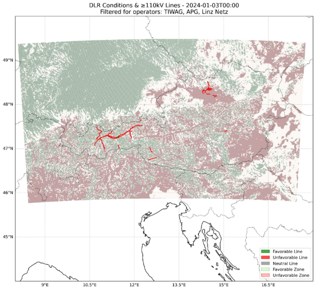
Through an interface co-designed with end users such as the Belgian Transmission System Operator (TSO) Elia and other TSOs, the Pilot Service provides a dynamic platform that integrates real-time and forecasted weather data with DLR algorithms. The service incorporates key atmospheric variables—including ambient temperature, relative humidity, wind direction, wind speed and global irradiation,—at adapted height levels (40-60m) relevant for overhead power lines.
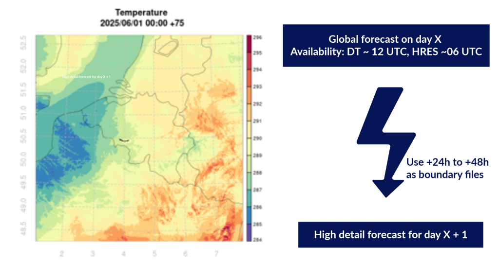
The objective is to provide the results through a user-friendly dashboard or API interface, giving grid operators direct access to actionable insights. The system should be capable of running high-resolution models up to 24 to 48 hours in advance, using boundary data from global forecasts to simulate conditions at a much finer scale.
Impact
The benefits of the Pilot Service extend well beyond operational improvements. By unlocking hidden capacity within the existing transmission infrastructure, grid operators can reduce the need for expensive reinforcements and minimise curtailment of renewable energy. This translates into direct cost savings, improved grid stability, and higher renewable energy penetration.
Operators using this service can expect transmission capacity gains of 10 to 25 percent, depending on conditions, particularly in regions with strong wind resources. These improvements allow better planning accuracy, reduced operational overhead, and a more flexible, responsive grid.
In addition, the project offers a pathway toward long-term sustainability. By minimising the reliance on physical DLR sensors and enabling a software-driven approach, the Pilot Service is faster and more cost-effective to deploy at scale. Its compatibility with the broader DestinE platform ensures long-term viability and integration within the evolving European digital infrastructure.
Project execution
The project is led by the Royal Meteorological Institute of Belgium (RMI), the Belgian national weather service recognised for its expertise in weather and climate research and forecasting. RMI coordinates a complementary consortium that combines scientific, technical and operational know‑how essential for delivering the Pilot Service for Dynamic Line Rating (DLR).
Alongside RMI, the consortium includes GeoSphere Austria, the Austrian national weather service, contributing high‑resolution meteorological modelling and detection algorithms; PropheSea, a specialist in artificial intelligence software for energy applications, responsible for user interface development and data integration; and Elia, the Belgian Transmission System Operator, which brings in practical operational expertise, end‑user requirements and real‑world validation.
Together, these four partners unite national weather services, industry experts and energy infrastructure operators to co‑design and implement an innovative, scientifically robust Pilot Service that supports the energy transition.